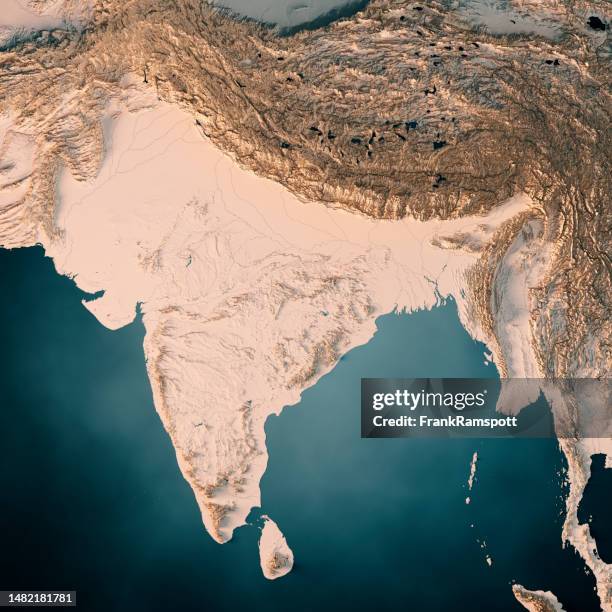
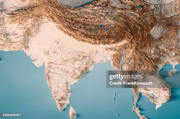
india 3d render topographic map dark ocean neutral - satellite view of bay of bengal stock pictures, royalty-free photos & images
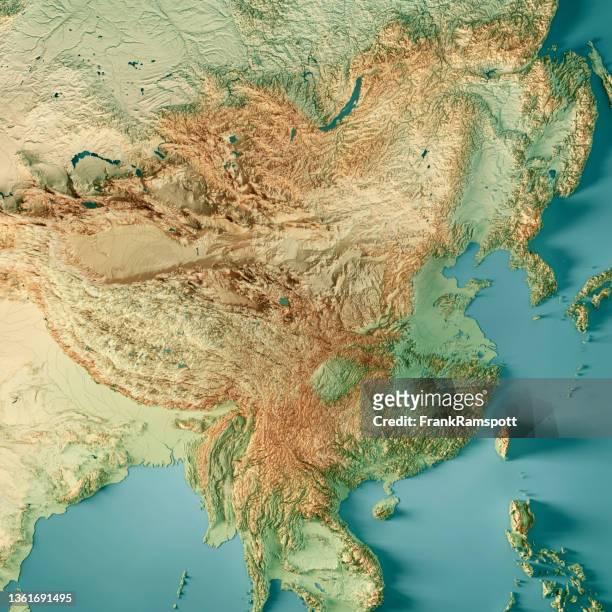
china 3d render topographic map color border - satellite view of bay of bengal stock pictures, royalty-free photos & images
True colour satellite image of the Ganges River that forms an extensive delta where it empties into the Bay of Bengal. The delta is largely covered...
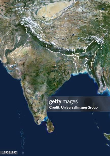
India, true colour satellite image with mask and border. This image shows the Indian subcontinent, bordered by Pakistan to the northwest and China...
india topographic map horizontal 3d render color - satellite view of bay of bengal stock pictures, royalty-free photos & images
India, true colour satellite image with border. This image shows the Indian subcontinent, bordered by Pakistan to the northwest and China and Nepal...
India, true colour satellite image. This image shows the Indian subcontinent, bordered by Pakistan to the northwest and China and Nepal to the...
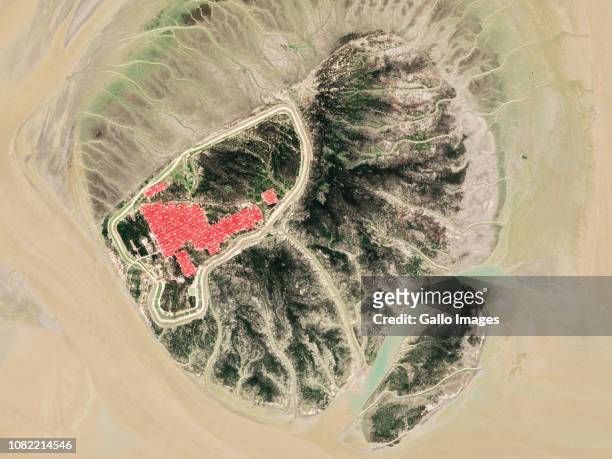
Rohingya Refugee camp development surrounded by the Bay of Bengal on the island of Bhasan Char of Bangladesh.
Satellite view of Sri Lanka. This image was compiled from data acquired by LANDSAT 5 & 7 satellites., Sri Lanka, Asia, True Colour Satellite Image
This Image taken from NASA's Internet site 12 April, 2001 shows the combined delta of the Ganges and Brahmaputra Rivers, the largest in the world....
The delta of the River Ganges empties into the Bay of Bengal in Bangladesh, as seen from the space shuttle Atlantis during NASA's STS-66 mission,...
india topographic map horizontal 3d render dark ocean neutral - satellite view of bay of bengal stock pictures, royalty-free photos & images
tropical storm bijli draped the east coast of india. - satellite view of bay of bengal stock pictures, royalty-free photos & images
may 1, 2008 - tropical cyclone nargis in the bay of bengal at 04:40 utc. - satellite view of bay of bengal stock pictures, royalty-free photos & images
may 21, 2014 - satellite view of a tropical cyclone in the bay of bengal. - satellite view of bay of bengal stock pictures, royalty-free photos & images
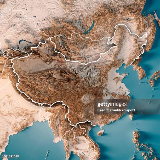
partial china map 3d rendered - satellite view of bay of bengal stock pictures, royalty-free photos & images
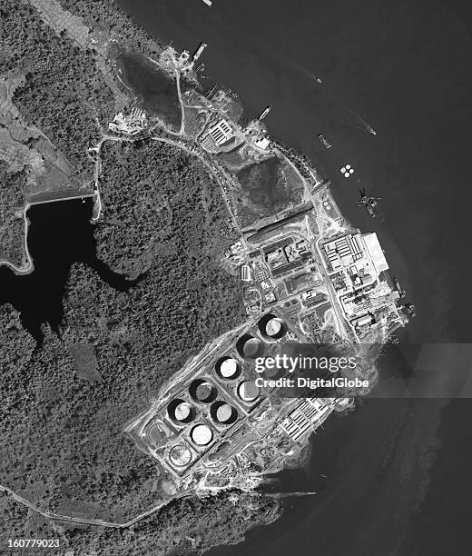
Construction on the trans-Burma oil and natural gas pipelines project is in its final stages. In 2008, China and Burma agreed on a USD $2.5-billion...
india topographic map horizontal 3d render dark ocean color - satellite view of bay of bengal stock pictures, royalty-free photos & images
china 3d render topographic map dark ocean color - satellite view of bay of bengal stock pictures, royalty-free photos & images
china 3d render topographic map dark ocean neutral - satellite view of bay of bengal stock pictures, royalty-free photos & images
india 3d render topographic map dark ocean color - satellite view of bay of bengal stock pictures, royalty-free photos & images
sri lanka topographic map 3d render neutral - satellite view of bay of bengal stock pictures, royalty-free photos & images
sri lanka topographic map 3d render color - satellite view of bay of bengal stock pictures, royalty-free photos & images
india topographic map horizontal 3d render neutral - satellite view of bay of bengal stock pictures, royalty-free photos & images
cyclone amphan 2020 cloud map bay of bengal 3d render color - satellite view of bay of bengal stock pictures, royalty-free photos & images
cyclone amphan 2020 cloud map bay of bengal 3d render neutral - satellite view of bay of bengal stock pictures, royalty-free photos & images
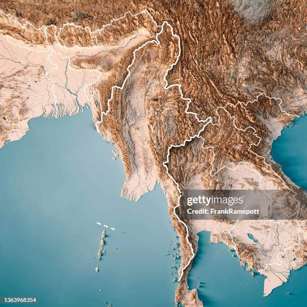
myanmar 3d render topographic map color - satellite view of bay of bengal stock pictures, royalty-free photos & images
myanmar 3d render topographic map neutral - satellite view of bay of bengal stock pictures, royalty-free photos & images
myanmar 3d render topographic map neutral border - satellite view of bay of bengal stock pictures, royalty-free photos & images
myanmar 3d render topographic map color border - satellite view of bay of bengal stock pictures, royalty-free photos & images
china 3d render topographic map neutral - satellite view of bay of bengal stock pictures, royalty-free photos & images
china 3d render topographic map neutral border - satellite view of bay of bengal stock pictures, royalty-free photos & images
china 3d render topographic map color - satellite view of bay of bengal stock pictures, royalty-free photos & images
Large areas of parts Bangladesh and India are under water,3 August 2003. Bright blue is rivers, lakes and flooded areas. Dark area left foreground is...
True colour satellite image of Krishna River Delta in India. The Krishna River flows into the Bay of Bengal. Composite image using LANDSAT 7 data.,...
Tropical Cyclone Nargis on May 1st 2008 off the coast of Burma . True-colour satellite image using MODIS data., Cyclone Nargis, Myanmar, In 2008,...
True colour satellite image of the Godavari River Delta in India. The Godavari River flows into the Bay of Bengal near the city of Rajahmundry ....
True colour satellite image of Irrawaddy Delta in Myanmar. The Irrawaddy River flows into the Bay of Bengal and Andaman Sea. On 2 May 2008, the delta...
Satellite view of Myanmar with mask. This image was compiled from data acquired by LANDSAT 5 & 7 satellites., Myanmar , Asia, True Colour Satellite...
Satellite view of Bangladesh . This image was compiled from data acquired by LANDSAT 5 & 7 satellites., Bangladesh, Asia, True Colour Satellite Image...
Satellite view of Myanmar . This image was compiled from data acquired by LANDSAT 5 & 7 satellites., Myanmar , Asia, True Colour Satellite Image With...
Satellite view of Myanmar with border. This image was compiled from data acquired by LANDSAT 5 & 7 satellites., Myanmar , Asia, True Colour Satellite...
Satellite view of Bangladesh . This image was compiled from data acquired by LANDSAT 5 & 7 satellites., Bangladesh, Asia, True Colour Satellite Image...
Satellite view of Bangladesh . This image was compiled from data acquired by LANDSAT 5 & 7 satellites., Bangladesh, Asia, True Colour Satellite Image...
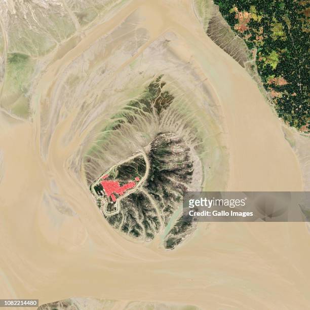
Bhasan Char Island also known as Char Piya in the Bay of Bengal is located in the Noakhali District of Bangladesh.