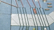
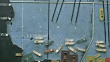
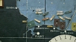
MS TD Shot of detail of map plotting the Normandy invasion showing lines from the English channel leading to the coast of Normandy and Omaha beach / Portsmouth, United Kingdom - stock video

PURCHASE A LICENCE
Get personalised pricing by telling us when, where, and how you want to use this asset.
DETAILS
Credit:
Creative #:
555806771
Licence type:
Rights-ready
Collection:
Smithsonian
Max file size:
1920 x 1080 px - 524 MB
Clip length:
00:00:19:03
Upload date:
Location:
Portsmouth, Unspecified, United Kingdom
Release info:
No release required
Mastered to:
QuickTime 10-bit ProRes 422 (HQ) HD 1920x1080 29.97p
Categories:
- D Day,
- 10 Seconds or Greater,
- 2014,
- Allied Forces,
- Arromanches,
- Battleship,
- Cartography,
- Close-Up,
- Coastline,
- Colour Image,
- Control Room,
- Day,
- Diagram,
- Diorama,
- Dwight Eisenhower,
- Film - Moving Image,
- HD Format,
- Horizontal,
- Indoors,
- Map,
- Military,
- Military Invasion,
- Model - Object,
- No People,
- Non US Film Location,
- Omaha Beach - Normandy,
- Organisation,
- Planning,
- Portsmouth - England,
- Real Time - Footage,
- Scale,
- Strategy,
- Tilt Down,
- UK,
- Western Script,
- World War II,